- Thumbnail
- Resource ID
- 83104a87-9d22-11e9-8d7d-000d3ab6a624
- Title
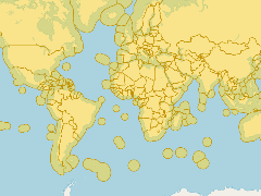
- Marine and land zones: the union of world country boundaries and EEZ's
- Date
- July 2, 2019, 6:38 p.m., Publication
- Abstract
- This dataset combines the boundaries of the world countries and the Exclusive Economic Zones of the world. It was created by combining the ESRI world country database and the EEZ version 8 dataset.
- Edition
- --
- Owner
- gridanode
- Point of Contact
- devrsgis@gmail.com
- Purpose
- --
- Maintenance Frequency
- None
- Type
- not filled
- Restrictions
- None
- None
- License
- None
- Language
- eng
- Temporal Extent
- Start
- --
- End
- --
- Supplemental Information
- No information provided
- Data Quality
- --
- Extent
-
- long min: -181.8000183105
- long max: 181.8000183105
- lat min: -90.8851165771
- lat max: 87.9090652466
- Spatial Reference System Identifier
- EPSG:900913
- Keywords
- no keywords
- Category
- None